Geologic mapping of the Japton and Witter 7.5-minute quadrangles was recently completed by the Arkansas Geological Survey’s STATEMAP field team. In Arkansas, the STATEMAP Program is currently focused on detailed 1:24,000-scale mapping in the Ozark Plateaus Region, located in the northern part of the state.

Figure 1. Japton and Witter Quadrangles on the 1:500,000-scale Geologic Map of Arkansas (Haley et al., 1993)

Geologic Map of the Japton Quadrangle, Madison County, Arkansas. Download a digital copy at:
http://www.geology.ar.gov/maps_pdf/geologic/24k_maps/Japton_24k_geologic.pdf

Geologic Map of the Witter Quadrangle, Madison County, Arkansas. Download a digital copy at:
http://www.geology.ar.gov/maps_pdf/geologic/24k_maps/Witter_24k_geologic.pdf
STATEMAP is a cooperative, matching-funds grant program administered by the U. S. Geological Survey. The goal of the program is to classify surface rocks into recognizable units based on a common lithology–basically, an inventory of surface materials. Also, we strive to locate and depict any structural elements that may have deformed the rocks. The rock units are classified into formations and members, and structures are described as synclines, anticlines, monoclines, and faults. During the project, a rich dataset was recorded in the field using a portable data collector/global positioning satellite receiver as well as by traditional methods. This made possible a more detailed depiction of geological and structural features and a more comprehensive description of lithology than previous studies had done. Data collection included:
-
629 field locations recorded and described in detail
-
3,385 photographs taken at recorded field locations
-
72 strike and dip measurements, most depicted on the maps
-
950 joint orientations, depicted in a rose diagram of strike frequency
-
1 shale pit
-
8 springs, previously undocumented
-
108 rock samples collected and described
The new map is useful to landowners interested in developing their land for personal or commercial purposes, to scientists seeking a better understanding of landscape evolution and geologic history, and to planners responsible for resource development and mitigating environmental impacts.
Angela Chandler, Principal Investigator for the project, wrote the grant for fiscal year 2018 and we received funding adequate to produce two maps. Two geologists, Richard Hutto and Garrett Hatzell, began their field season last July and after putting in 76 days in the field, concluded that portion of their work in February of this year. The area of investigation lies within the Interior Highlands Physiographic Region in north Arkansas, specifically the Boston Mountains Plateau portion of the Ozark Plateaus Province. Previous work by the AGS in this area had been done in preparation for the 1:500,000-scale Geologic Map of Arkansas by Haley et al. circa 1976 (see Fig. 1). That mapping project delineated five stratigraphic units in this area, but through extensive field reconnaissance, we were able to define ten units on these maps at the 1:24,000 scale. Further division is possible, but several units were considered too thin to depict on the 40-foot contours of the topographic map currently available, or too difficult to delineate by lithology alone.
Several tributaries of the White River are located on these quadrangles including Lollars Creek, Drakes Creek, and War Eagle Creek. The White River is a major water resource in Arkansas and southern Missouri, and as such we need to learn as much as we can about this important watershed. Included in the field work was hiking, wading, or swimming the entire 13-mile stretch of War Eagle Creek located within the Witter quadrangle, the 10 miles of Lollars Creek within the Japton, and many smaller drainages. The reason we concentrate our efforts on stream beds is that there, erosion has typically removed soil and loose rock leaving well-exposed outcrops of bedrock for us to study. Also, being able to see the entire stack of the rock sequence as we move up or downstream helps put each formation in context with the others. Discovering where one formation contacts another is one of the most important things we do while mapping. Because formations are laterally extensive, similar contacts can be connected into a contact line separating one formation from another. Figuring out where to draw these lines on the map is a major goal of the project.
From mid-February through the end of June, we analyzed field data, classified rock specimens, drew formation contacts and structures on the map, then handed it off to our cartography staff to digitize. Final layout and production of the maps was accomplished by the geologists, after which they were subjected to an extensive review and editing process by fellow staff.
The following images were taken during this year’s field season. Hopefully, they will provide a small glimpse into some of what we were privileged to experience in the field this year. They are arranged in stratigraphic order from youngest to oldest:

![DSCN1957[14]](https://arkansasgeological.files.wordpress.com/2018/07/dscn1957141.jpg "Landslide on Highway 23 above Dry Fork")
Alluvium in War Eagle Creek (left). Landslide on Highway 23 above Dry Fork (right).

Ball and pillow structures in the Atoka Formation in Drakes Creek.


Sequence of photos zooming into herringbone cross-beds in the Greenland Member of the Atoka Formation.

Large blocks of Kessler Limestone sliding into Lollar’s Creek.


Sequence of photos zooming into oncolitic limestone of the Kessler Member of the Bloyd Formation. The oncolite pictured far right is nucleated on a tabulate coral.

Lycopod (tree-like plant) fossil weathering out of the Dye Shale.


Top of the Parthenon sandstone (Bloyd Formation) in Lollar’s Creek (left). Parthenon resting on the Brentwood Limestone (Bloyd Formation) with travertine precipitating at the drip line (right).


Siltstone unit in the upper Brentwood Limestone. Cross-bedded (left) and bioturbated (right).

Biohermal mounds in the Brentwood Limestone in Jackson Creek.

Massive bluff of limey sandstone in the Prairie Grove Member of the Hale Formation.


Sandy limestone in the Prairie Grove. Stream abrasion has revealed cross-bedding (left) and an ammonoid (right).


Typical thin-, ripple-bedded sandstone of the Cane Hill Member of the Hale Formation (left). A basal conglomerate in the Cane Hill contains fossiliferous and oolitic limestone pebbles and fossil fragments (right). This unit probably rests on the Mississippian-Pennsylvanian unconformity.

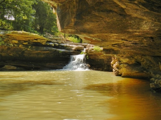
The Pitkin Limestone in War Eagle Creek.
This year we will be mapping the Weathers quadrangle which is just east of the Witter, and the Delaney quadrangle which is just south of the Durham (which we mapped two years ago). The Kings River flows through Weathers, so this should be a good place to start while river levels are low (and it’s so hot!). I will update you as I can, but until then, I’ll see you in the field!
Richard Hutto